aggienaut: (Default)
Thursday we checked out of our airbnb in Flowerpot, Tas. The owners live in a house on the property but we never did see them, guess they were busy these past three days.

We proceeded about an hour up to, through and past Hobart town, over the bridge over the Derwent (which we've learned had a horrifying incident in the 70s when a ship collided with its supports, a section fell down sinking the ship, and several cars flew off the gap.) to the town of Richmond which was another cute town of Victorian looking little storefronts. This one looked very well maintained and flourishing (as opposed to the cute Victorian houses of Bothwell which were all kind of in a state of decay). Our destination here was the "Poo-seum"


I wasn't actually sure i was looking forward to this. Poop.. doesn't appeal to me, shall we say. But mom is a science teacher (mostly but not entirely retired) and she was very intrigued. So the museum is basically dedicated to animal poop. There were examples of the poop of many different animals, carefully preserved in a manner that kept it looking just as you might find it on a trail. Along with lots and lots of information. It was actually rather interesting. Though i remain grossed out that gorillas eat their own poop (because it's only like 20% digested each time it goes through) 🤮


There was also apparently a maze in this town as well as a 1:16 scale model of early Hobart, but we had a ferry to catch in the evening so we didn't have time for all that. But we did have a delicious meal in one of the cafes in town


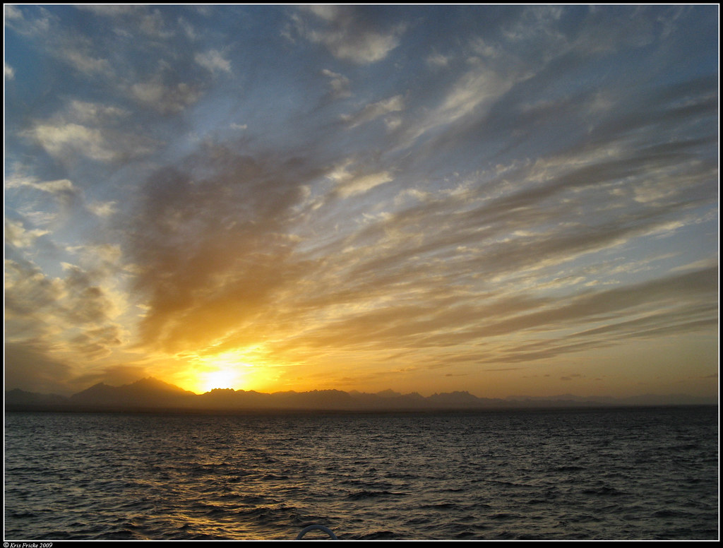
From there we drove up to the ferry terminal in north Tasmania, three hours across the country, and we once again boarded and took the overnight ferry back to the mainland.

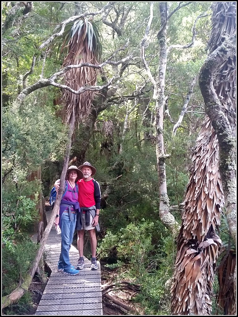
There's lots of places still to visit in the world but I'm sure I'll be back in Tassie with Cristina if nothing else. In the South i wanted to visit the Hartz Mountains near where we were but didn't end up fitting it in. I'd actually really like to go on the big multi day hike through there southwest wilderness. I hope Cristina likes hiking. Also I want to get back to the MONA museum while not pressed for time. And then there's the whole East Coast of Tassie i haven't seen yet, which i think is often the first place people go so presumably there's stuff to see there.
aggienaut: (Default)


Wednesday morning we drove about fifteen minutes to the Bruny Island Ferry, which departs every twenty minutes so we didn't have long to wait. Presently it arrived and disgorged an implausible number of vehicles. Around 11:30 we began our crossing of the channel, which only took about fifteen minutes.

First we drove to the northern tip of the island. The northern (and presumably southern) lobes are big enough that while in inland valleys you can't even tell you're on an island. Land use was mostly pasture or eucalypt woodland. There was a little township at the north end but we couldn't find the heritage trail indicated on the map. Proceeded south.

Next stop was a cheese and beer place. They had a very nice outdoor set up with a pleasant atmosphere and it seemed popular. We got a cheese platter and a milk stout (dark beer). The cheese platter had some cooked wallaby on it too.


From there we proceeded a short distance to Bruny Island Honey. Obviously it's not novel to me to see a honey/bee place but I was interested in their presentation and such. And it was really good! Much better presentation than we have at Edmonds Honey. If bossman ever shows interest in substantially redecorating these pictures will be good reference. Also they had some tasty honey-vanilla ice cream.

Next we were headed down the isthmus, which as you can see on the top map is very thin. It does however have a solid hillock right down its middle. About halfway down there was a boardwalk with steps to the top. There are penguin burrows all over the central sandy hillock but we didn't see any penguins, i think it's not the nesting season (and even when it is your primarily see them just after sunset)


At the southern end of the isthmus there was supposed to be a trailhead but we couldn't find it either.

Just at the top end of the southern lobe we went into a chocolateria, selling us chocolate should have been the easiest thing but their presentation was as bad as the honey place was good. Just a shed w self serve chocolates along one wall. I'd kind of expected fancy hot chocolates and all kinds of tempting goodies. We left there without getting anything.

Proceeding down the east side of the southern lobe we came to Adventure Bay. The bay is named after the HMS Adventure which was part of Captain Cook's famous expedition, and had become lost, wandering into the bay alone. Captain Bligh anchored here for reprovisioning in the HMS Bounty a few years later on his own famous journey.

And then we flew past a "Bligh Museum" it was little and came up suddenly. I really wanted to go in but there wasn't a convenient turn around :(


And then there was a tallship! We were able to pull over so i could get a good shot. I think this was the Lady Nelson which we'd seen at the wharf in Hobart.


Finally at the end of this road we found a trailhead. And saw our first live wallaby! By a wallaby cut out!

I would have liked to hike longer but by now we were feeling strained for time -- if we missed the ferry off the island we'd be stuck! So we just went half an hour out and came back. It was a nice well maintained trail ("grass point trail") through forest woodland just beside the coast. According to informational signs here too there were a bunch of whalers huts from whence they'd dart out and nab hapless passing whales.


From there we proceeded straight to the ferry. They don't check tickets getting back on the ferry since they only sell round trip and obviously you got one to get here. Ferry 17:45-18:00


Ate at a pub in the nearby town of Snug that looked like it couldn't decide if it was a nice tourist spot or a grungy local pub. The tables were nice and if you just faced the tables and windows from the bar maybe you'd think it was the former, but the bar itself looked like it belonged to a grungy backwater and though the food was good they didn't have any local Tassie beers or ciders on tap, just the same tastes-of-bootleather mass produced macro lagers you could probably find in the mines in the NT.


And then we returned to our cabin and lit a fire in the stove, the end (until next day update). In the meantime we just boarded the ferry back to the mainland (:
aggienaut: (Default)
After leaving Hobart on Monday we headed southwest about 45 minutes to our next airbnb, a little cabin in a place on the coast named Flowerpot.

dot on our final destination of Cockle Creek, not Flowerpot

Tuesday we headed south about two hours to the end of the road. This entire drive, including the Monday portion to Flowerpot, is through absolutely beautiful countryside. The road mostly follows the coast, though occasionally cutting across peninsulas. The coast itself is extremely squiggly here and dramatically hilly, and across the water (with cute sailboats upon it) there's inevitably either more squiggles of the same coast or islands. The countryside is bucolic, cute small towns, orchards, artisinal this and that shops, interspersed with eucalypt woodland. Until we got to the very southern end of the road and then it was mostly impenetrably thick forest on either side.

Now this road doesn't go to the southernmost point of Tasmania, it would take days of hiking to get there. In fact if you look at a map of Tasmania about a quarter of the island in the southwest is entirely undeveloped, no roads or anything. I'd love to someday go on a multi day hike through there.


By and by we arrived at the end of the road at Cockle Creek. It seems like as far as you can go from anywhere now but apparently was once a whaling station with 2,000 people. There's a cute whale statue. Cute until you realize the disturbing fact that they used to slaughter whale calves like the one in the sculpture.


We went for a walk a few miles along the coast (an hour out, hour back), the beach sand was fine and white, the water clear and turquoise blue. The shore being lined with thick forest up to the edge it looked live a Caribbean paradise if you didn't know it was quite chilly and ignored that there were no palm trees. Across the water was dramatic silhouettes of mountains to the north and northwest, faint rows of islands to the northeast, and where we came around and could see out to sea to the southeast one could see huge distant breakers crashing on a reef -- i think it's thousands of miles across the Great Southern Ocean from here before there's any land.


Because he's a maniac dad had to go for a swim. If you look closely you can see him splashing along in the above picture. When he came out he declared it felt like 62f, just like back home in California!


You can see the difference between previous picture and this one, at clouds blew over it was constantly changing from sunny and brightly colored to cloud shadowed and cold. I was constantly taking my jacket on and off.

And then we drove back to our Flowerpot. It felt like we spent most of the day driving there and back but the views along the way recall cliche sayings about how it's all about those journey!

The more we travel the more we seem to come up with things to do "next time" -- there was a longer hike leaving from Cockle Creek I'd love to hit up "next time"
aggienaut: (Default)


So at 14:00 we arrived at our airbnb in Hobart. It was one unit of this brick row, which is housing constructed in 1847 for shipyard workers. Suitably restored to be nice and comfortable, though the floors were still a spot uneven and it unfortunately smelt strongly of fresh paint. (And the host left us no trashcan at all!?). The location was an old part of town full of these really old houses, now all beautifully restored to make for a very nice part of town (a tour guide later told us horror stories about developers wanting to put parking lots and gas stations in place of historic buildings, fortunately mostly defeated)

Above picture of mom and dad smooching is from later, after dad's race.


The lavender in front of our unit was full of bumblebees! There are no bumblebees on mainland Australia so i was very excited to see these adorable little aerial kittens of the insect world.


Saturday morning the very famous weekly "Salamanca Market" was in full swing on Salamanca Square right at the historic wharf district of Hobart.


There was lots of cool stuff at the market. I really wanted this clock. But not quite $225 of wanting it. Mom bought some insects-in-clear-resin earrings at same booth.


There's a tallship festival afoot at the same wharf area this week. Actually the Melbourne tallship Enterprize that i volunteer on is currently making its way up the coast to here. I could have been sailing on it if it wasn't that my parents are visiting now. Someday I'll join it for that sail.


Dad ran the Tasmania 70.3 Ironman on Sunday. First time it's been put on here. Mom and i volunteered, controlling a pedestrian crossing near the bike transition point. Dad reported the bike portion was the hilliest he's experienced ("there were short hills, long hills, steep hills, and steeper hills"). He came in second in his age group.


On Monday we cleared out of our airbnb and then went to the famous MONA museum of modern art. Unfortunately we had to clear out of our prime parking spot at the airbnb and the only parking anywhere near the ferry departure point was a maximum of 3 hours. Being as the ferry took about forty minutes (including time spent queueing and waiting for it), this left one feeling panicked for time while at the museum. It was fun taking the dedicated museum ferry though. Museum was neat, definitely an immersive experience. I found individual exhibits more often than not obtuse but the overall ambience was the experience i guess, though again the fact that one inevitably feels panicked for time detracted from that. Maybe I'm showing myself as a big prude here but the first gallery was an expressly NSFW one with graphically naked people including what looked like a man being raped by a pitbull (???), and i didn't terribly enjoy it. Because that was the first gallery one is dumped into that was probably the one we saw the most of and then hurried through the rest and i feel like we only saw about a third of everything.

On our return to the car we had a $45 parking fine despite our efforts.

After that we headed south for our next airbnb, where I'm writing this, but that'll be another entry!

It's been beautiful days in the 70s f (20s c), between this trip and last time the weather has been consistently better here in Southern Tasmania than where i live in Victoria.

Tasmania 1

Feb. 6th, 2023 02:08 pm
aggienaut: (Default)


Last time we took the ferry we had had to catch it from downtown Melbourne but it has since conveniently moved to geelong.

Thursday around 18:00 we boarded the Spirit of Tasmania ferry. I think the company runs two ships both by the same name and according to a promotional video seen on board plans to expand to Spirits of Tasmania 3-5. Not big on creative ship names it seems.

Food in the buffet on board seemed like it would have been good if it wasn't all barely lukewarm.

We occupied a table just near the back windows (on deck 7 of 10!) and watched the city of Geelong recede behind us, with the refineries and big ship docks to its right (from our perspective). Though with the sun setting right behind the city and glare off rain drops on the windows it was a bit hard to see. The skyscape was a somewhat picturesque combination of bright golden glow where the sun was shining through and dark storm clouds dropping walls of water here and there and threatening to overtake us. Meanwhile to our left, ship's starboard, rolling green hills of the Bellarine peninsula slid past.

My parents went to bed around 21:00, we had to get up around 04:45 to begin disembarkation after all. I really wanted to feel the sea beneath my feet so I stayed up reading (this book i really highly recommend about WWI in East Africa, "African Kaiser") until we crossed "the rip" at the entrance to Port Phillip Bay (around 22:15) and immediately the deck began lurching. The captain had actually taken to the intercom earlier to advise that this would be a stormy passage with 35 knot winds out in Bass Strait. It brought a smile to my face to feel the deck swaying beneath me again and i walked a lap of the ship to enjoy it before going down to our cabin (this time we had our own cabin, quite nice little space, though it was in an internal space w no porthole).


Around 06:23 we disembarked the ferry into the foggy dim pre dawn light. There were some cafes open early just off the ferry no doubt for the ferry passengers but we chose to put a few miles under us first. Fog was so thick we could only just see the car in front of us on the highway. Google maps on my phone seems to be a bit quirky and several times i caught it about to send us on a wild goose chase. Definitely blindly following the map wasn't a thing to do.

Stopped for breakfast at a nice little Cafe in the middle of countryside called Elizabeth Town Cafe (ETC). Then we made a second attempt to visit a visitor information center but as with the earlier attempt it wasn't open yet. But Google maps from here routed us on a different route to Hobart, the A5 through the central highlands rather than the A1. We'd taken the A1 before and while still very scenic its also the major thoroughfare and busy and straight. The A5 wound through forests and mountains and was very pleasant.


Stopped at a short (400m) hike hike near the highest point on the road, along a boardwalk through highlands heath and some fun bog. It was very cold and there was actual ice on the boardwalk where it was in shadow.

Coming down the other side of the highlands we stopped in a little town called Bothwell full of cute little circa 1850s stone buildings. It could be used as a set for a movie. Finally got into a visitor information center, it was a combination "golf museum" since the "oldest golf course in Australia" is right there. I'm not into golf. I walked through this museum portion and found it to be comprehensively boring.

Information center attendant was very friendly but informative on nice walks seemed to be an particular blind spot to him. He couldn't think of any, though everything I've heard is that Tassie is chock a block with nice bush walks. Finally he directed us to take a scenic back road (the c179) which we did and it was kind of fun to see a bit of rural off-the-highway Tassie. Remote modern farm houses with solar panels, falling down old farm houses, lonely chimneys marking former farm houses.

By and by we reached Hobart (or as i keep calling it just to be silly, "Hobert"). Hobert is the capital and biggest city of Tasmania. Something like 40% of the population of the island live in Hobart. It's the second oldest city in Australia and is picturesquely wrapped around both sides of the Derwent estuary and various islands therein. It only takes about three hours to get across the island if we'd hurried. As it is we arrived at our airbnb literally two or three minutes past our 2pm check-in. And I'll make another entry about Hobart (-: presently on the Mona Ferry.

Also, much later i realized i forgot a small but crucial thing in our cabin on the ferry. My wall-socket-to-USB plug. So now i have to borrow one from my parents when they're not using it. Fortunately it's usually free overnight but for example tonight (adding this Monday night) they've already gone to bed and i hadn't gotten it from them yet so i guess i can't charge anything overnight tonight and will be mostly phoneless (ie camera-less!) tomorrow.😭
aggienaut: (Numbat)

Saturday, February 24th, 2018 - We awoke to the first rainy day of our whole week in Tasmania. People say "it's cold!" down in Tasmania and allege the weather is much worse, but from my brief experience, we had a solid week of lovely sunny days in Tasmania whereas at home in Victoria I don't think we've had more than three days of sunny weather in a row all year, and even three in a row has happened maybe once or twice. I asked friends back home if they were getting the same week of nice weather and they said they were not, so there you have it, weather in Tasmania is great, case closed!

   We'd spent the night at an airbnb in a rural area on the peninsula between Hobart and Port Arthur, in this case a woman was airbnbing out a self contained section of her house. She was very nice. Mom wanted to visit with the farm animals and chooks (chickens) said to be on the property but in the pouring rain it wasn't very appealing to go mucking about. Well for some of us. For my dad, there was one thing he wanted to do: go swim in the ocean!!
   Following directions from our kindly host, we proceeded to nearby Pipe Clay Lagoon, which as were driving up beside it appeared to at the time consist of mud flats and/or a centimeter of water with happy water birds walking around looking for tasty snacks. What was really kind of neat though was on the sand bar section between the lagoon and the sea, there was literally no road but one drove on the sand (on the lagoon side) and there were houses on the sand bar whose driveways just went into the sand. Our host had mentioned that at high tides the water is up to the bottom of the driveways. Guess one has to plan one's comings and goings!
   Because it was still raining, when we parked and walked to the sea-side there was no one at all on the beach there. Dad declared the water to be (62? 65f?), which is actually similar to the ocean water temperature in California, in which he swims alll the tiime. So he went in and soon he was just a distant splish splashing arm. While he did this mom and I strolled up the beach looking for keen shells. There was quite a large amount of nice shells on the beach. Also the boiler of a ship that ran aground there in the 20s or thirties I believe (there was an informational plaque but I don't actually recall the date).

   By and by dad returned, invigorated and happy. He had swam in the ocean at the southernmost point any of us has ever been (save for Port Arthur the day before which looks like it has a few kilometers southing on this place but hey thats quibbling)! Now he was feeling celebratory so we decided to look for a nice place for breakfast. We had noticed on the maps a canal that appeared to not quite cut through a narrow neck in the peninsula and decided to investigate!! While so doing we found a nice restaurant overlooking the canal and settled in for a rather fancy brunch (at first I mom and I were thinking it looked a bit fancier than our usual lunch budget, but like I said, dad was feeling very festive - "it's our last day in Tasmania!"). While there we learned the canal had been built (in the 20s? 30s? I'm just gonna go ahead and assume every date I can't remember falls in that area) after intense lobbying by local farmers who wanted to I guess shorten the shipping route to bring their products to market in Hobart by boat (though looking at the map it really doesn't look that far around). After building the canal at a fair expense it was only briefly operational before storms silted up the seaward end of it, and constantly dredging this build-up proved unfeasible. So today it's just a canal to nowhere, with the seaward end completely built-over.


   Our plan for this morning WAS to go to the famous Salamanca Market, which everyone was saying we needed to go to, but being as it was totally pouring we decided to maybe take a rain check on the market (I can picture [livejournal.com profile] tassie_gal throwing up her arms in utter consternation at us here ::hides::).

   Instead we decided to hit an animal sanctuary on our way back north. We headed north, off the peninsula, and skirted along the east side of the Derwent estuary, with Hobart town across the way (though a fair bit of it had overgrown onto this side as well). About half an hour north of the city we came to the Bonorong Wildlife Sanctuary, here, conveniently, the rain had stopped and the weather was once again rather pleasant. We caught a guided tour by an elderly guide who mom (and dad agreed I believe) swore was the spitting image of my dad's mom, whom I barely knew, so I tried to get a good look. Here I suppose I really ought to describe said guide but I'm not sure how. She was a bit wirey, with white hair that looked like it had once been red, irish features.
   The sanctuary had the obligatory hundred or more tame kangaroos one can feed, lounging around living the good life, but we steamed right past these boring dime a dozen animals to see the famous Tasmanian devils. It turns out, you know, they look nothing like the cartoon character at all. They look kind of like large (small dog sized) stocky rats. And apparently are prone to tumors which makes them, um, really a bit ugly most of the time. I couldn't really get a good picture of one, they're very restless and I kept getting pictures of their back or otherwise ruined pictures, this is the best I got. They're mainly scavangers and opportunist eaters of anything they can get their hands on, and I realized they share their belligerent temperament with a lot of other animals that also fill that niche such as hyenas, and jackals; I guess it comes with the territory. Some of the enclosures had a chew toy on a bungee as an "animal enrichment item" to simulate the tug of war over a piece of meat they might regularly get in with their compatriots in the wild.
   When my grandmother's lookalike moved on to the koalas we peeled away, admired the cute echidna a bit (sign there said that echidnas are actually very smart with an unusually large brain for their size), fed some kangaroos (look at this cute kangaroo family, and note the tail and leg of the joey hiding in his mother's pouch here), managed not to accidentally feed the kookaburra, and were all a bit mind-bizorgled to learn from the sign that one cockatoo they had was over a hundred years old!! I knew some parrots live a really long time, such as the alleged* parrot of Winston Churchill which is still alive at 119 years old, but now I'm looking around at the huge flock of cockatoos that live around my house and thinking jesus any of these could be a hundred years old!

* while fact checking this claim I was sadly disillusioned to learn that the Churchill estate firmly maintains he owned no such parrot.


   From here we headed right across the island to return to the ferry terminal at Devonport. The land through the middle was idyllic rolling farm land. I tried to pull up some Beatles songs on youtube since my memory of childhood roadtrips with my parents were always accompanied by Beatles music (my dad is a big fan). The Beatles estate must be good at keeping the music off the freetube though because all I could find were crummy live recordings.
   I think we all thought there'd be some kind of cafe or something available at the ferry terminal, but once we checked in at around six and were let in to the car corral, there was no cafe other than someone selling coffee out of the back of a not-even-van-sized vehicle, and a very utilitarian toilet block, and we couldn't leave the corral area! Since the boat wasn't leaving till (9?) we realized we probably shouldn't have checked in so early, needlessly condemning ourselves to a few hours incarceration in literally a parking lot on a nice Tasmanian afternoon.

   This time we had a "family cabin" to ourselves, which was basically the exact same four bunk room but no weirdo strangers. Trip back was quite uneventful. Both my parents got up at 5 to witness the crossing of "the rip" into Prince Phillip Bay but having caught it on the way out I was happy to keep sleeping. Rousted up at 7:15 for an 8ish arrival. Had breakfast in one of Melbourne's cute laneways. Earlier planning had played with the idea of seeing some of Melbourne while we were there but I think we all agreed we were ready to go home, and proceeded back to my place.
   But not without stopping at another wildlife sanctuary!! On the northern outskirts of Geelong there is the Serendip Sanctuary! Whereas the other one had been pay entry and swarming with staff, Serendip is nice and quiet -- it's well maintained but I've never seen any staff, and it's free entry. Billie used to live just near it and we went a few times, it's a nice peaceful place to stroll and look at the animals. We saw emu and brolgas as well as wallabies and more kangaroos. They have some nice wetland areas where the viewing area is accessed through an entirely enclosed walkway and viewing is done thorugh slits in the wall, so the birds don't get started, and dozens of different kinds of birds can be seen. My mom in particular is a bit fond of birding so she enjoyed seeing so many different species all in one place. In addition to the open wetlands (birds there are all just naturally visiting of their own volition), there were also several large aviaries with dry land and scrub birds. Altogether a fun place for a peaceful stroll and/or seeing some birds. As always when I visit we only saw a handful of other people.

   And the next day, Monday, I had work! And my parents left on Wednesday! The End! Altogether a lovely visit and I think we're all very much looking forward to next time already.


   Total journey through Tasmania:

aggienaut: (Tactical Gear)

Saturday, February 23rd, 1856 - the small schooner comes into the cove and luffs up, the small experienced crew needing just a few gestures from the captain for directions. Amidships the prisoners are lined up on deck, their chains clanking, under the supervision of red coated soldiers. The forested hills surrounding the cove are starkly beautiful, but also cold and imposing. From the jumble of buildings that make up the penal colony a longboat rowed by prisoners is making its way to the boat. Murray looks at the grim faces of the rowing prisoners as the longboat comes up to take a line from the schooner and tow her in to the dock.
   "It can't get any worse" Murray remembers thinking wryly when he'd first arrived in Australia, "I've already been sentenced to transportation for the term of my natural life!" But he was wrong, it can always get worse. The convicts laborously towed the schooner in to Port Arthur, a place of secondary punishment.


Friday, February 23rd, 2018 - the cruise liner P&O Pacific Jewel comes into the cove lets its huge anchor hurtle down into the water. The passengers line the rails admiring the starkly beautiful forested hills, and point at the ruined buildings of Port Arther. After a few minutes the tenders are ready to ferry interested passengers in to the dock. As the geriatric passengers are helped onto the floating dock they are greeted by smiling guides. Welcome to Port Arthur.

   "Hey, isn't that the ship we saw earlier from the Queenscliff ferry?" I ask my dad, pointing at the white cruiseliner out in the cove. Later discussion with self-confessed shipnerd [livejournal.com profile] wantedonvoyage confirms it probably was. We had driven here from Hobart, about an hour and a half across a coastline that was a jumble of inlets and peninsulas, and across the tiny neck of land said to have been guarded by chained dogs to prevent escape from Port Arthur, to arrive here at this most famous of penal settlements.
   Port Arther was "a place of secondary punishment," meaning that if someone had already been sentenced to be transported to Australia and committed another crime, they got shipped here. As well though persons guilty of murder and other serious crimes could be shipped directly to Port Arthur.
   And if someone shipped to Port Arthur needs to be punished yet more? A "Separate Prison"on the panopticon design was built at Port Arthur where the inmates permitted no contact at all with eachother and even the guards didn't talk so there'd be no human interaction at all. And if that's not enough? It can always get worse! Further punishment for these inmates would consist of being locked in a dark closet sized room behind several big doors so there's no light or sound. And after that? They found they had to build one of the world's first psych wards when this treatment proved capable of driving people insane.

   The area is starkly beautiful, with its steep forested and mist shrouded mountains rising from the sea and numerous islands, but I gather it wasn't a very fun place to be sent as a convict. Aside from generally cold weather, the completely alien plant an animal life from their home, with the sheer distance from their home, must have made it feel like today's equivalent of being sent to Mars never to return. The prisoners worked at various industries, timber cutting and sawmilling was a major one, and logs were transported in the area on a tramway pulled by convicts. Among the other industries, they also had a shipyard and built boats until they were forced to close it -- because they were successfully competing with other commercial shipyards that actually had to pay their labor.


   We spent the entire day looking at Port Arthur. As it came time to go I had one last place I wanted to visit. Behind a hedge we found the quiet and contemplative memorial garden, with a reflection pool reflecting the empty shell of the former visitor cafe where 22 people were shot in the space of 15-30 seconds on April 28th, 1996. Nearby a plaque on a small obelisk contains the names of the 35 fatalities in the Port Arthur Shooting. After this shooting the Australian government imposed strict gun controls and there hasn't been a mass shooting in Australia since. This was all the more poignant since it was coming just a few days after the most recent school shooting in the United States.
   One other thing that I've noted about the Port Arthur Shooting -- the shooters name is never mentioned. It is known, it's in the wikipedia article, but I feel like whereas in shootings in the states the shooter's name is emblazoned across all the headlines, a sort of damnatio memoriae has been generally agreed in this case.

aggienaut: (Numbat)

Monday, November 24th, 1642 - Two fluyts are making their way across the limitless southern seas, their sails full and taut with the trade winds. A look-out up in the Zeehaen's crosstrees, huddling against the cold, looks out toward the grey horizon, where the sun should soon appear. The first golden sliver appears, straight ahead, and as the sea begins to sparkle the golden orb rises from the flat sea. But wait, is the sea not perfectly flat there? The sailor peers towards the sun, though it is quickly beginning to hurt his eyes. Salty spray stings his eyes but he squints fit to bore a tunnel, and, yes, there appear to be mountains silhouetted against the rising sun! He stares for a moment longer to be sure and then calls out, "laaaand hoooooooooo!" Moments later Captain Tasman has climbed up from deck and stands on the topyard, holding the mast with one hand and shielding his eyes with the other.


and here's actually a picture I took of the Red Sea coast of Egypt in 2009 because Captain Tasman didn't allow cameras in the rigging ):


Thursday, February 22nd, 2018, Zeehan, Tasmania - I had thought Zeehan was just a corruption of Zion or something, but it turns out Zeehaen, one of Tasman's two ships, means "sea hen" in Dutch. The town is named after the nearby Mt Zeehan which is believed to be what Abel Tasman first sighted in 1642, thus becoming the first European to see what would become Tasmania.

   That morning in Zeehan, I was delighted to find bumblebees (pictured below) busy visiting the flowers around the cottage -- there are no bumblebees on the Australian mainland, and Australians, famous for nonchalantly noting "you call that a spoider?" and "you call that a snoike?" and generally being entirely unimpressed with anyone else's animals, can be seen to jump and exclaim when seeing a bumblebee for the first time and insist that "you wouldn't believe it!!" when trying to describe it to another Australian.

   First stop, let's just drive through downtown. We were only a block or two away, and these intervening blocks showed a sad depressed old mining town ... but downtown mainstreet there was a cluster of beautiful grand old buildings with big facades and verandas. There was a museum with several steam locomotives under an awning. We decided to give this museum, the Western Heritage Museum a go and it turned out to be quite an impressive museum!! They specialized a bit in the mining history of the area, and had at least three rooms full of samples of minerals from all over the world, which mom found very exciting being a geology enthusiast. They also had a huge amount of historical artifacts, photos and information covering the entire western region of Tasmania. And a complete blacksmiths shop, and a number of historic water wheels and the locomotives and and and... we were forced to tear ourselves away before even seeing anything because we had the long run to Hobart this day.
   But first! The people we'd talked to in the Mushroom Cafe in Waratah the previous morning had said we needed to visit the "Spray Tunnel" in Zeehan. It turned out to be just out of town, about ten minutes down a curvy one lane dirt road with absolutely impenetrable bush on either side -- which made me marvel at the early prospectors who had somehow tromped around out here through that stuff looking for likely mining locations. We were concerned what would happen if we met another car on this road since there weren't even turn-outs, but presently we came to a small open area, the little parking area for the Spray Tunnel! There was of course an informational plaque, and there it was, a hole in the mountainside through which you could see light at the other end. The Spray Tunnel! Apparently an "adit" of the Spray Mine. We walked through it, marveling at the lack of graffiti.


   And now we really had to hoof it. We had planned to visit the nearby port town of Strahan, and I believe dad and I still wanted to but mom eventually won out that we didn't have time any more. So we set course for the the island's capitol, Hobart!

   Heading south-east through mountainous forested terrain, we soon came around a corner to see a completely denuded mountain looming above the town of Queenstown. Queenstown itself looked cute though, with once again a lot of beautiful old-timey looking buildings in town (in this case a few blocks of them). While it looked like the mountain behind town was one giant strip mine, and the river running through town ran a rusty brown, the town seemed healthier than Zeehan, possibly getting more tourist traffic since its on a main highway. Passing through downtown we were excited to see a steam locomotive actually chugging along outside of what appeared to probably be a rail museum. We quickly tried to park and take a picture of it but it was slinking into the railshed by the time I was able to get a picture. We didn't feel we had time to poke around any of the museums here, so we kept on trucking.
   For the next three hours we drove through beautiful natural landscapes -- you'll notice no the embedded map that nearly a third of Tasmania, consisting of most of this southwest corner, is national park. We remarked that it looked like it could be Yosemite, as the forests and meadows flitted by. Yosemite with eucalyptii. About half the journey was in national park but even once we got out of it things weren't very developed, just the very occasional small town.


   Finally about half an hour from our destination, we came to a town called New Norforlk where we crossed the river Derwent (which eventually becomes the big estuary Hobart is on), by way of a little bridge, and from here to our destination we were driving through urban area. Which isn't to say Hobart is huge, with a population of 222,000 its only a bit bigger than my nearby town of Geelong (177,023). It actually reminded me a bit of Portland Oregon (which is three times as big at 640,000). All of Tasmania only has 520,000 people, so half the island's population lives in Hobart.

   Driving in we noted what looked like "a bond villian lair" on an island in the Derwest estuary -- apparently that's the famous MONA art museum, only reachable by boat!

   We checked into our airbnb in a cute narrow house reminiscent of something one might find wedged in in San Franscisco. This time we were just getting a room from a woman who lived on premises. She was very nice. I coveted her crockery, when did I become someone who covets crockery? But just look at those pleasing simple patterns and nice elegant shapes.

   From there we walked a block to a street (Elizabeth Street) that was just restaurants and eateries for several blocks. It was at this point that I decided I loved this town! Making a decision was a bit difficult with all the options -- dad and I both were salivating for a $13 rump steak special at a brewery but mom was not having it and instead we had some very tasty thai. Walked back to the airbnb looking forward to the next two days in the Hobart area!

aggienaut: (Numbat)

Wednesday, February 21st, Waratah, Tasmania - We woke up to find ourselves on a precipice! Right in the very middle of town! The town of Waratah, it seems, is built right around a chasm, with a waterfall cascading down into it, right in the middle of town! Apparently the early pioneers saw this chasm and thought "ahah, we shall harness the mighty power of this convenient waterfall to mill osmiridium!" Which totally sounds like a made up mineral used as a mcguffin in a movie or game, like the "unobtainium" in Avatar. But compare this impressive old photo of their mcguffin mills to the previous link showing it now!

   Our airbnb had actually been a few blocks away from the abyss, so we didn't wake up just beside it exactly per se. But it was still a bit of a surprise. We had headed off in search of "downtown" for some coffee, and found instead a giant chasm where downtown should be. Though the town had obviously seen better days, it still had another one of those grand old hotels, looking much as it had in ye olden days. Just beside the hotel was a rather funny cafe -- "the MUSH Room" was in a rather nondescript but oldish looking building, inside the decorations were very eclectic, but what struck me the most was the wide open kitchen looked like it had almost nothing in it. Like a coffee machine and microwave or something. It seems a bit odd. Also there were pictures of mushrooms all over, and books about mushrooms sitting around. Originally I was just gonna run in and get a coffee, and mom had come in with me, but we looked at eachother and said "dad needs to come in here!" because he's rather a fan of mushrooms. While waiting for my coffee we got to talking to a nice couple who gave us some more tips on things to see (though I think they themselves were only in Tassie as tourists?).


   From Waratah we headed to Dove Lake, about an hour toward the middle of the island, through mostly forests, land cleared by logging, and replanted plantations. Dove Lake is near (at the base of?) Cradle Mountain, which I've gathered is one of the most famous destinations in Tasmania. I still don't really quite see how it looks like a cradle though. At the visitor center car park we had to park in the overflow parking lot it was so busy. One can drive to the trailhead parking lot sometimes if it's not too busy, but it was too busy on this day so one had to get a bus up from the visitor center. About twenty minutes on the comfortable bus (and they run like every five minutes) winding up a beautiful valley with several stops at different trailheads. Dove Lake is the end of the road and I'm not sure anyone on the bus was going anywhere else. From the trailhead start one has a good view of cradle mountain just behind the lake -- there was even a sign with a bracket to guide you to take the classic picture of the scene ... which I declined to take because it seemed way to cliche (why take a photo a million other people have taken?). Instead I took a picture of the big drones prohibited sign, thinking "what a world we live in, where people have to be warned to keep their flying robots at bay."


and also took this one of the lake and Cradle Mountain and a boat shed

   The hike around the lake was a very lovely two-hour-ish hike, extremely well maintained. Large parts of it were on boardwalk, in places over the lake itself where the bank rose basically in a cliff around the lake. One can go on further loops to make the hike even longer if one so desires. Also I learned from signs in the vicinity that there's an epic transtasmanian "Overland Track" hiking trail that begins here and crosses most of the relatively wild and undeveloped southwest of the island. Something to potentially do some day!! Also the every popular wombat poo track ... I think some larrikan just stole the L from "wombat pool" ;)

   After this delightful hike we tried to visit the interpretive center but it had closed at 3 and we arrived at 3:06. While waiting for the next bus from this stop we went on another lovely short loop walk. Finally got back to the main visitor center hoping for a snack at the cafe ... only to find IT closed literally a minute before we arrived at 4:01. Such sauce. This is the most popular tourist destination in Tasmania, there are five more hours of daylight, and everything is shutting down before normal business hours are even up? WTF Tasmania.


   From Dove Lake we headed off to that ever popular must-see, Zeehan. Okay maybe not but my coworker is from there so we thought we'd swing through. It was about an hour and a half away, through a series of small mining towns as the road wound around small mountains. At one point we were alarmed to see a car protruding just off the road from a small gully! It was so fresh looking our first instinct was to pull over and see if someone needed assistance, but then we noticed the tires were gone and wheel mounts rusty. We hypothesize that the car really did crash there, but rather than tow it out the local council opted to keep it freshly painted as a clear warning to passing motorists to be careful.


Here's a calidendrous bit of forest on the Dove Lake loop

   Dad's search for accomodation in this sector had found slim pickins, but eventually he had called the local pub (called a hotel but usually they don't actually have accomodation) on said coworker's recommendation (not that she _recommended_ it, just that it was a local accomodation possibility) and it turned out they could put us up in a little miner's cottage next to the hotel! How quaint!
   The hotel turned out to be yet again one of these grand old 19th century gingerbread edifices, which seemed a bit out of place in what was obviously a down-on-its-luck former mining town. The hotel bar was full of "tradies" in their dirty high viz uniforms (Australians in any job that even remotely resembles blue collar seem to inevitably be wearing flourescent high visibility uniforms), the restaurant room was a cavernous hall that seemed to dwarf the few tables in it. The menu had a surprising selection of chinese food on it, clearly they had a chinese cook. Food was a very long time coming but that seemed entirely in keeping with this sleepy backwater of a place.

   Back at the cottage, another evening of watching the olympics. Doping in curling? Really Russia?? Really??? Even other curler's were like "uh, WHY??"


Mom and dad on the Dove Lake Loop

aggienaut: (Numbat)

Tuesday, February 20th, Dismal Swamp, the Tarkine Wilderness - "Wait, which way is it?" asks dad, looking from the small map to the junction in the boardwalk "this junction isn't even on here!" I look at the map myself and as far as I can tell this junction is indeed not on the map. We are lost literally and figuratively deep in the dismal swamp!


   The day at begun at our little airbnb bungalow outside of Stanley. We had only been working up the plan for this day since yesterday and as soon as I saw "dismal swamp" on the map I knew we had to go there. I didn't really care what was or wasn't there, just, why WOULDN'T one want to visit a place called "dismal swamp??"
   The weather was sunny, with a cool breeze, which I realized with alarm reminded me of Autumn! If one accounts for the flipped year, February does equal August, so indeed the summer is coming to an end! Mom was eyeing some wild birds out the window "those look like chickens, are they chickens??" they looked just enough not like chickens to make one wonder. Mom got out the bird book and determined that they were in fact some kind of native bush-chicken, I believe?

   Our first destination was a coffee shop and bakery in the nearby town of Smithton (once again small, built around an estuary, with a busy little mainstreet), where the woman behind the counter was remarkably friendly. Smithton also had a small museum, which was closed, but we could see through the window the (plastic casts of, presumably) bones of a prehistoric giant wombat (a diprotodon I believe?) , and read the informational sign about it. Also, I think it was in the dismal swamp we learned about it actually, but while I'm on a paragraph about ancient megafauna: you've undoubtedly heard of the Tasmanian devil, you may (should) have heard of the Tasmanian tiger, but did you know there was also a Tasmanian lion (Which for some reason has a separate wikipedia entry under the name thylacoleo! The Tasmanian Lion is believed to have been extincted (extunck?) by the arrival of aboriginals around 60,000 years ago. The last confirmed living Tasmanian Tiger of course sadly died in a zoo in 1933 due to neglectfully being locked out of it's shelter during extreme weather ):< ...and I just learned just this moment that the closest living relative of the Tasmanian Tiger is the NUMBAT, which is the adorable little critter in my default icon!

   Next stop, Dismal Swamp!! --Or, as they're making a vague effort to rebrand it, "Tarkine Forest Adventures!" ...what's wrong with "dismal swamp???" Anyway the Dismal Swamp is a privately run "eco adventure" thing. There's 40 meter deep sinkhole (I can't find a good "about" page on the internet but the area of the sinkhole is hundreds of hectares actually I think? its big anyway). One drive up and parks in the car park, surrounded by walls of forest. From the gift-shop / cafe / ticketing area one can take "the longest slide in the southern hemisphere" (110 meters) down to the bottom ... for a hefty $25 roo-bucks. Or one can walk down via the lovely and well-maintained boardwalks, which we did.
   Down at the bottom there was a network of these nice boardwalks and it was really lovely being deep in such a delightful swamp. They had lots of informational little signs about the trees and plants, which mom in particular was really excited about. Another remarkable thing I learned from the signs was that there were crayfish who lived on the muddy swamp floor here and made themselves little crayfish towers. We saw their towers but not the crayfish themselves. We enjoyed strolling around the swamp for maybe two hours before dad started to get antsy that we needed to keep a move on for the rest of our planned perambulations. As noted at the beginning of the entry, we found we got a bit lost trying to navigate the unintentionally labyrinthine boardwalks on our way out, but not too badly. All in all I loved the dismal swamps, they were every bit as delightful as I had expected, and more!!


   From there we booked it to the west coast of the island, through mostly bucolic farm countryside. Visited the coast itself and beheld an isolated and idyllic surf beach, but being pressed for time we only looked at it from the car park and got back on the road. Headed south down the coast it was clear this is not the highly populated part of the island, as for miles and miles we saw nothing but brush around the road, and the roadkilled-padme-per-kilometer index was at almost zero. Despite this we saw fairly regular signs advising to be careful not to run over devils from dusk to dawn, as well as signs that appeared to warn of kangaroos lifting one's car, no doubt after having become addicted to human-introduced crossfit ::shakes head sadly::. On our whole coastal drive we only drove through one tiny micro-townlet, it really felt like a very remote and unpeopled coast.

   After half an hour running down parallel to the coast we turned inland (apparently the road continues to a miniscule former town that was once the port to a now closed mine and is now "just a collection of shacks." Our journey inland back into the Tarkine Wilderness led us into alternating forest and cleared land, with signs proclaiming we were witnessing managed sustainable logging or some such. Eventually I believe we entered a protected state forest and the huge surrounding trees were uninterrupted. We also passed several turnoffs just off the road with pallets of beehives on them, which of course we were intrigued to see. The hives had a lot of supers (additional boxes) stacked on top which would seem to indicate they were doing really well, and indeed they all seemed very busy at the entrances. Interesting to note, I'm not sure if anyone reading this is interested in the obscurities of comparative beekeeping, but I was interested to note while most commercial beekeepers in at least the states prefer to give the bees about two "deep" boxes before stacking shallow honey supers on top these operations seemed to use entirely shallows. I've been thinking about doing that if I were to god forbid restart, since I don't like having differing box sizes and am currently using all deeps, which get gosh darn heavy when full of honey.

   There were many many short walk options within the Tarkine Wilderness loop, but we had to zip right past most of them due to our ambition drive plan. Maybe some day I'll get back! ::looks off whistfully into the distance:: We managed to stop at a nice lookout point, and planned to stop to see a "flooded sinkhole" but accidentally zipped past it and there was nowhere to turn around. We did stop at the "Trowutta Arch" though. It consisted of a pleasant half hour walk through what an informational sign described as, I swear, "calidendrous," but I'm feeling a bit consternated because I wanted to double check the spelling and no variation comes up with ANY hits of any kind on Teh Google. But according to the sign this word means "beautiful or park-like forest" and referes to the wide airy space between the trees here under the canopy high above. It was indeed well beautious.


If adventure games taught me anything it's that I need to stand under that vine and type "climb vine"

   The "arch" it turned out was two side-by-side sinkholes which were connected by a big hole. One sinkhole was filled in allowing access and the other had a pool of water in the bottom. Pretty neat!

   From there we more-or-less hoofed it back up to civilization back at Smithton, and used main roads (such as they are in Tasmania) to get to our destination for the night about two hours away. First we traveled east along the coastal road we had come west on and then turned south, and noted that the padme-roadkill-per-kilometer was extremely high (like double digits) on this main corridor in the "relatively" densely populated north. When we got further from the coast it got less populated again and finally just as the sun was settomg we rolled into the little mining town of Waratah which seemed a bit isolated in the mountains. It was both cute and visibly run down, and had pleasant looking ponds right in the center of town. After we established ourselves in our airbnb (a little house that had been brought up to good repair and set up seemingly expressly for this purpose), inspired by platypus crossing signs we went out to see if we could see platypii in the ponds. Sadly no luck, I think the moon was mostly behind clouds again, I remember it being VERY dark. We stumbled through the darkness back to the house to watch some Olympics instead.

   In the morning would we discover we had been on the edge of a precipice? Would we figure out why the famed "Cradle Mountain" is so called? Find out next entry! :D

aggienaut: (Numbat)

Monday, February 19th, Devonport - the sky is slate grey and casts a dreary industrial look on the town around the waterfront. Across the estuary the Spirit of Tasmania ferry we'd recently debarked looks like a giant toy with its discordantly optimistic red and white. I'm standing under giant bronze statues of flowers. There's a nearby explanational sign, and informational signs always attract me like bees to a flower. These poppies, it informs me, are a monument to the importance to the local economy of legal poppy farming -- under close government regulation they raise opiate poppies for use in commercial pharmaceuticals. "Such sauce!" I say to mom. Dad returns from his quick dash to a better vantage point to photo the ship.


   Next stop, Ulverstone! Mission: Scallop pies! My coworker here (not Cato, though I'm sure he'd loorve a scallop* pie) is a native** Tasmanian*** and had informed me the first thing she always does when getting off the ferry is proceed straight to Crusty's Bakery in Ulverstone for a scallop pie. Ulverstone is only about twenty minutes west along a coast dotted with little seaside towns interspersed with farmland. We found Ulverstone to be another one of these little seaside towns built up around an estuary (at a population of 6,985, wikipedia informs me it's "one of the largest towns in Tasmania"), with several bakeries on the main street buzzing with business like a beehive on a sunny morning. Beside Crusty's was one of those grand old hotels with beautiful gilt second floor wraparound verandas which we would see many of throughout the island. At Crusty's we got one scallop pie and two pasties ("pahsties," a thing I fondly remember from Ireland but Not A Thing in the States). The scallop pie was.. interesting but not my favorite.

*As noted last entry, they say "scallop" not as "scahl-op" as god intended but more like ::does some green room voice exercises before coming back:: "skwau-lope." As the week went on we found scallope pies weren't just a specialty of this bakery, rather all of Tasmania seems to have a thing for them. Later, I asked my friend whom my other friends always bag out for being Tasmanian if he secretly craves scallop pies while living on the mainland, he admitted he didn't actually, to which I declared he was not truly Tasmanian, and he then admitted to being born in Bendigo on the Australian mainland, thus proving the efficacy of scallop pie love as a test of someone's true Tasmanianism.

**My coworker was born in Tasmania, which is not to be confused with being aboriginal. The plight of the aboriginal peoples of Tasmania is truly appalling. By 1876 the last full blooded aboriginal was declared to have died and the government declared they were an extinct peoples and "the aboriginal problem" was over. To this day the perception prevails in Australia that the native people's of Tasmania were entirely wiped out. As it happens wikipedia informs me that one full blooded aboriginal did live till 1905, and of persons who are partially aboriginal the last census indicated there were 23,576 in Tasmania at the 2016 census.
   Considering the genocides and forced migrations of the native peoples of Australia happened around the same time as the same was happening to the native peoples of North America, I find it interesting to see how different the cultural awareness of it is. Everyone in America is "aware" that terrible things happened to the native Americans, but its not like here where it is mentioned all the time, most events open with an acknowledgement of the "traditional owners of this land," the local mall has a plaque to them, etc etc. Conversely, I think 99% of the people living in Southern California haven't the faintest idea what the name of the native tribe of their area was (Tongva in OC, though I cheated and looked it up just now, I thought it was the Chumash, who are just north, but vaguely remembered enough to suspect that wasn't exactly right) and probably think of amerindians as something that happened somewhere else.

***While I'm on Tasmanian history, the island was called Van Dieman's Land until 1856, until they changed it partially (largely?) as a branding/marketing move to get away from the terrible Vandiemonic reputation as a harsh destination for convicts (which had just been discontinued). Early references to people living there referred to them as Vandiemonians though, which I think is a fun demonym (a van diemonym?? ohohoho okay okay I'll stop).


   From Ulverstone we set out to continue west through more farmland and seaside townlets until we came to "Fossil Bluff" and "Table Cape," and mom does love a good fossil. We turned off the highway (which was only a curvy two lane thing anyway) to proceed down a windy country road along farms and coastal bluffs. Had to stop at a beautiful field of sunflowers. By now the sun had come out to make for a beautiful scene of sunflowers fields draped over the slopes by the coast. Neighboring fields had already been harvested of a flower crop, but the big signs on the gate declared:
      WARNING: DO NOT ENTER.
      THIS CROP HAS KILLED PEOPLE!!

   O_o. Reading the smaller print one learns that these are the commercial poppy fields! The wording of the sign makes one picture man eating plants in the field but I suppose they mean if you steal poppies to make and use heroin you might die? I feel like the wild claim that the crop will kill you draws more attention to it than a simple "DO . NOT . ENTER" sign would.
   Continuing on the pleasant winding road to the table cape we also saw signs for the nearby allegedly famous tulip farms but I don't recall seeing them. And there was a deer farm!! Golly, Tasmania has the most whimsical industries!!
   Went on a pleasant walk along a precarous seaside cliff from a lookout point to a lighthouse, but as admission was ($20?) which we felt was steep and we decided not to go in. Then drove down to fossil bluff beach and saw some of the usual million year old embedded shells. I think a sign indicated the actual fossil bluff was a ten minute walk from there but we were getting antsy to keep on moving west at that point.

   I almost forgot one other very strong first impression we got. Plastered on walls in the towns, and showing up in the most unlikely places among sunflower (and opiate) fields, there was an overwhelming number of election campaign signs. I swear I've never seen such concentrations of them. And the viciousness of their declarations on rival parties! Sure US state and national elections get nasty but the local elections usually keep the slander to a background whisper, but despite population levels more akin to most place's town elections, it was clear these politicians were out to gouge eachother's proverbial eyes out with their proverbial thumbs. "Liberals" (whom I had to keep reminding my parents are actually analogous to Republicans in America) seemed to have the most signs, but even between Labor and the Greens there seemed to be no love lost, with one memorably sign by Labor saying they promised not to work with the Greens. Anyway, as I said I almost forgot this except just now I checked my newsfeed and saw that the Liberals had won the election and the Greens declared it "the most bought election in Tasmanian history."
   I think the vehemence of the politics may stem from the fact that you have this small island with beautiful pristine forests full or rare species, but also logging is the major industry, so the conservatives really really want to support the logging industry and the liberals people-on-the-left really really want to protect the forests.


View looking back from atop "The Nut" at the narrow isthmus connecting Stanly to the Tasmanian mainland

   Only about an hour west we reached our destination, the town of Stanley, situated out on a peninsula that had formed behind a volcanic plug known as "the nut." The town itself was really cute, reminded me of a New England fishing village. Apparently a major film meant to be set in the 1800s was recently filmed there since all the buildings downtown look period appropriate.
   We took the chairlift up to the top of the nut and went on the very lovely walkabout around the top. Much of it was covered in sort of heath, but one low part was forested and within this beautiful forested bit was saw our first pademelons -- basically smaller more rounded wallebies. Sadly the pad-melons most commonly are seen smashed by the side of the road and as we continued to drive around Tasmania one can gauge how much nighttime traffic a section of road gets by the smashed-padmé-per-kilometer ratio.
   At the base of The Nut I had some lavendar icecream which I found remarkably good, and now I wonder why one doesn't see more of this delicious flavor.

   That evening we ate at the Stanley Hotel as it was the only place open (I think my parents would have preferred somewhere cheaper, it was a bit fancy, but it was good!!). Also, being the only place open on a Monday night the place was reservation only and after initially showing up at (6?) we had to come back at 7:30.
   That evening we went out to see the penguins -- on our earlier penguin adventure we had caught a mention that penguins also show up on the shores of Tasmania and a bit of research had revealed that this was one of the places! The beach did have designated penguin viewing locations and signs once again admonishing people not to take photos of the poor little penguins since the blue light in flashes hurts their wee little penguin eyes. As it happens we were staring into the inky blackness (moon largely obscured by clouds) at a designated location with about a dozen other tourists when a series of bright camera flashes down the path caught our attention. We ventured that way and found a little penguin paralyzed in fear on the path as some ill behaved tourist took a few more pictures.

   We then managed to run over no padmes at all on the return to our little airbnb (a custom made airbnb bungalow outside a main house) just out of town. And thus ended a delightful Day 1 in Tasmania!

aggienaut: (Numbat)

Sunday, February 18th - In the dark evening with a smattering of raindrops upon the window (just enough to make pictures come out really badly) we drove up the tall narrow ramp -- more like a one lane bridge really. The lights of the classic Titanic-esque hull of the Queen Mary II are just off to our right and a little further forward, making it seem smaller than the red and white Spirit of Tasmania II that looms up right in front of us. While the whole front of the Queenscliff ferries opens like a whaleshark, the Spirit of Tasmania seems to suck them aboard with a straw, into a narrow one-car-wide entrance at the very beak of the prow.

   Once aboard we were directed up a ramp to park in one of three lines of cars on the port side .. it took awhile for me to orient myself since we had driven in from the front and were facing aft -- it being already dark even once we were moving one got no sense of direction looknig out of the windows so I kept having a hard time keeping track of which was port or starboard or fore or aft. Once parked we took everything we'd need for the night (no vehicle access during transit) and headed to the central stairwells. I was excited because I haven't ever been on a cruise or overnight ferry (except this one time in Sweden in 1999 which is longer ago than I can remember). Family cabins hadn't been available anymore when dad booked most of a week previously, so mom was in a four person women's cabin and dad and I were in a similar men's cabin. The hallways were so narrow one had to back up against the wall to let another person pass. The rooms were of course small but comfortable, with two bunkbeds, a desk that I can't imagine anyone using since it would obstruct everyone else and the llight wouldn't be appreciated t night, and a bathroom. After putting our stuff on our beds we went upstairs -- our car was on deck 6, rooms on deck 8, most of the length of deck 7 was "lounge," chairs and TVs. Deck 9 was crew only and 10 was also sort of lounge style but mostly deserted -- maybe it's more popular on day transits. There was of course a bar on the main lounge deck, but they had a very very small selection, not one beer remotely resembling craft and didn't even KNOW what a the traditional sailor's drink the "dark and stormy" is (ginger beer and rum), which is weird because its not nearly as obscure in Aus as in the States, most bars in Australia seem to have it in can. There was also a restaurant which we didn't partake of outbound but on our return we did and some of the buffet style food was pretty good. At the front (or was it aft, I really don't know!) was a room that was kept dark and full of recliners for people who didn't want to fork out the dough for a cabin -- I'm told it's really uncomfortable, and really, after paying $100ish (AUD, so like $75US), it seems silly to balk at paying another $33aud for a bunk in the dorm style cabins. Another economic mystery is it seemed like some people do this transit all the time, but flying costs abut HALF AS MUCH (google search just now is giving me $89 and $112 round trip options) and takes a fraction of the time. Obv the ferry is the only option if you want to take your car but seemed like some of the regulars take the ferry to commute regularly for work between Melbourne and Tassie and you really don't need a car to get around Melbourne.


Web photo since I don't have any worth posting from this episode but believe every entry should have a picture.

   We settled down to watch the Olympics, which fortunately was on about half the TVs in the lounge. As I mentioned before, we as a family don't watch much TV, but we have always watched the olympics. To me the Olympics is a special family tradition that feels almost like Christmas, since I can remember even as a very young kid getting to stay up later than usual to watch the olympics with my parents. We also none of us follow team sports at all, personally I can't even begin to comprehend how people can get excited about teams that really just represent a brand name, none of the players come from the city they "represent" and get traded around all the time, and one pointless season of pointless sporting and appalling scandals follows endlessly on another. But things like the Olympics I feel represent inspiring acts of true sportsmanship and striving for excellence, as well as national honor in fun way which allows one to get excited and root for countries one has a connection to.

   My parents being early-birds as usual went to bed much earlier than me, but I was enjoying the Olympics and wanted to still be up when we crossed the bar out of the broad bay Melbourne is at the back of. I believe we had departed around 9pm, and for the first few hours there was no feeling at all of wave movement. Finally, around 12:40am the vessel began to noticably buck a bit. I went out on deck to find the air warm despite the brisk ocean breeze, and we were just passing the Queencliff lighthouse. I walked through to the port side and saw the darker Point Nepean sliding past with the Sorrento lights further down the peninsula. At this point the boat had enough of a galloping motion that one stumbled around like a drunkard. Most of the rest of the passengers had gone to bed and crewmembers were cleaning up the lounge area. I've had a few locals ask me since if we had a "rough passage," and I'm never sure what to say, was this rough? It's relative. I've sailed in gale conditions with 18 foot swells in a 100 foot schooner, when even the most experienced crewmember kept a barf bag at hand any time they were belowdecks -- THAT was "rough." This was just enough to be fun and make me nostalgic for my sailing days.

   Made my way to my cabin happily bouncing off the walls like I was in a pinball machine. Tried to enter the cabin as quietly as I could and climbed onto my bunk with just the light from my phone -- apparently not the norm of courtesy here: my mom's roommates apparently routinely turned on the lights when they got up (and one was in the bathroom for two hours in the morning!), and when one of my roommates (who had a remarkable ability to loudly mumble profanities in his sleep) got up at 5am he had no compunction about turning on the blazing lights. The ship's announcements gave everyone a wake up announcement 45 minutes from arrival, I think around 7:15, using nice non-jarring tones. Dad and I talked a bit to the fourth member of our cabin, a regular on this route, who gave us some tips to see in Tassie. I forget exactly how we found mom, maybe she tapped on our door, anyway it turned out she'd already been up for some time (see also roommates turning on lights in her room). We went up to deck 10 to get some coffee and watch Tasmania approach. At first it appeared as a series of mountains with golden light shining down upon it through the clouds. Gradually it got closer and bigger until the town of Devonport lay around us in the dull grey morning light. Drivers were instructed to board their cars deck by deck and presently our call came. Recall we'd gone up a ramp to park, we appeared to be on an entire deck that would elevator down when the deck below cleared, and from a few cars ahead of us one could see the cars exiting below out the big opening in the back. A car near the very front of one of the rows below us (with door open here), an elegant classic car of some type, was unable to start and holding up the whole row behind it. After some ten minutes a RACV (Australian AAA) car came on on the ramp and jumped it -- I was really surprised the ferry didn't have portable jumping kits itself considering that out of a load of 700 cars at least one probably won't start every time. Finally our deck lowered down and we were off down the ramp and onto Tasmanian soil. I kept asking my parents "can you believe we're in Tasmania?? Did you ever think you' be in Tasmania??" Would we see the famous Tasmanian Devil? Maybe discover the last Tasmanian Tiger?? Tasmanian Lion??? Visit dismal swamps? Drive into a mine shaft? Eat scallop pies*?? All that and more will be answered in future entries!!

*just last night my Australian friends laughed at me for the way I say scallop ("scah-lop") and instructed me it's, let me see if I can get this right, ::does jaw excercises::, "skwau--loup?"

April 2025

S M T W T F S
  123 45
6 7 89101112
13141516171819
20 212223242526
27282930   

Syndicate

RSS Atom

Most Popular Tags

Style Credit

Expand Cut Tags

No cut tags
Page generated Jun. 12th, 2025 11:37 am
Powered by Dreamwidth Studios